Climate Zones Exploration
An engaging worksheet for Grade 10 Social Studies students to explore and understand different climate zones, their characteristics, and global distribution.
Includes
Standards
Topics
Climate Zones Exploration
Name:
Date:
Score:
Read each question carefully and provide thoughtful answers. Use the provided map to assist in answering some questions.
Refer to the map below to answer the following questions.
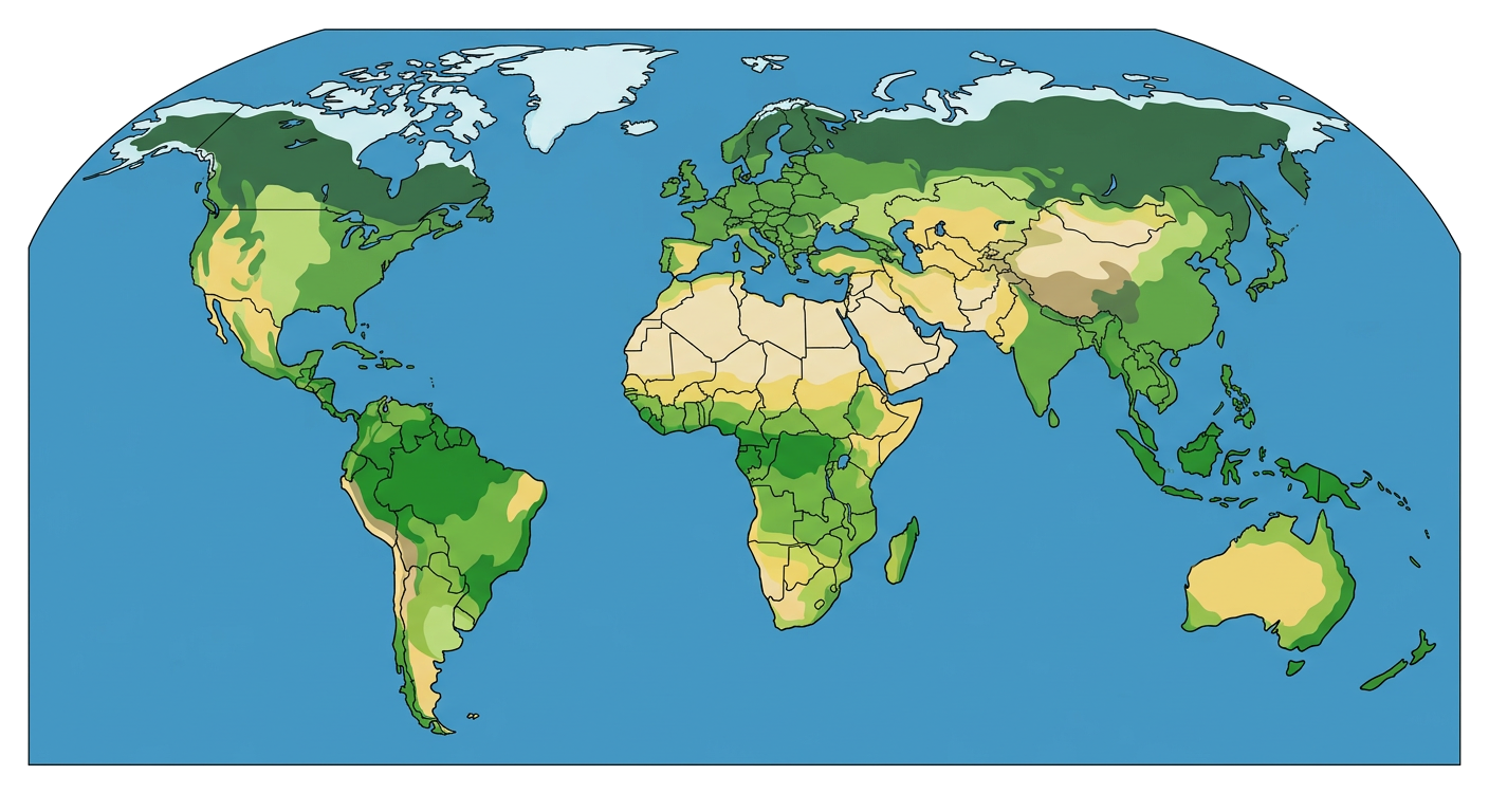
1. Which climate zone is characterized by hot, humid conditions and abundant rainfall year-round?
Polar
Tropical Wet
Arid
Temperate
2. Which of the following factors primarily influences the climate of a region?
Population density
Latitude
Local cuisine
Political system
3. The climate zone found at the Earth's poles is known as the climate.
4. Mediterranean climates are typically characterized by hot, dry summers and winters.
5. Describe two distinct characteristics of a desert climate zone.
6. Explain how ocean currents can influence the climate of coastal regions.
7. Tundra climate zones are typically found at high altitudes and are characterized by permafrost.
True
False
8. The Equator passes through regions with predominantly polar climates.
True
False
Match each climate zone with its primary characteristic.
9. Tropical Wet & Dry
a. Very cold, low precipitation, permafrost
10. Humid Subtropical
b. Warm to hot summers, mild winters, year-round precipitation
11. Tundra
c. Distinct wet and dry seasons