Geographical Boundaries Worksheet
Explore different types of geographical boundaries, their formation, and their impact on human societies and international relations.
Includes
Standards
Topics
Geographical Boundaries: An Introduction
Name:
Date:
Score:
Read each question carefully and provide thoughtful answers based on your knowledge of geographical boundaries. Some questions may require you to analyze the provided map.
1. Define what a 'geographical boundary' is and provide two distinct examples of how they can be formed.
2. Which of the following is an example of a relict boundary?
The border between the United States and Canada.
The Great Wall of China.
The Berlin Wall, after its fall.
The border between North and South Korea.
3. A boundary that is drawn before the development of the cultural landscape is known as a boundary, while a boundary that is established after the cultural landscape has been formed is called a boundary.
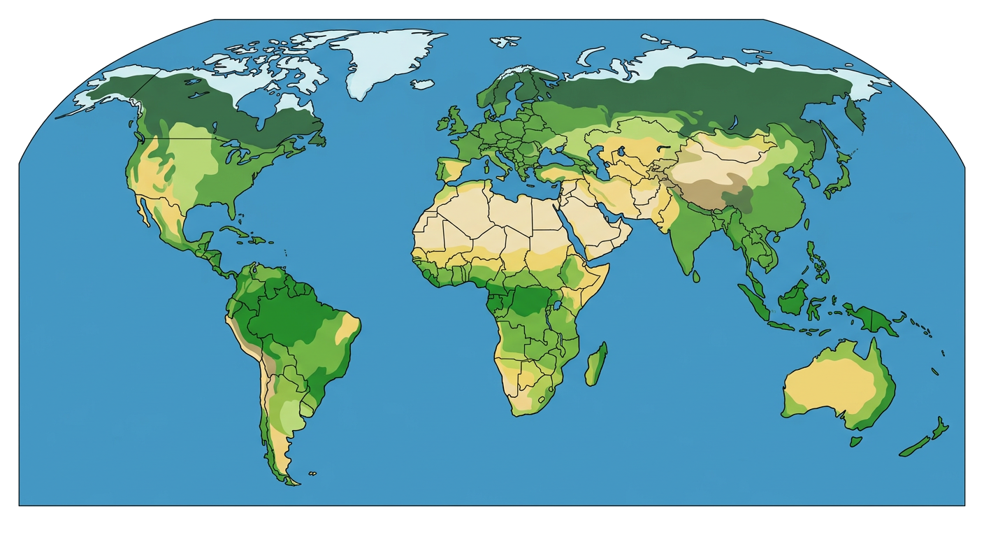
4. Examine the 'Biome World Map' below. Identify two countries that share a significant physical geographical boundary (e.g., a mountain range or a major river). Explain how this boundary might influence their political, economic, or cultural interactions.
5. Artificial boundaries, also known as geometric boundaries, always follow straight lines of latitude or longitude.
True
False
6. Discuss how definitional, locational, operational, and allocational boundary disputes can arise. Provide a brief real-world example for at least two of these types of disputes.