Ocean Water Movements Worksheet
Explore the forces driving ocean currents, tides, and waves, and their impact on global climate and ecosystems.
Includes
Standards
Topics
Ocean Water Movements
Name:
Date:
Score:
Read each question carefully and answer to the best of your ability.
1. What is the primary force responsible for the movement of ocean tides?
Wind patterns
Earth's rotation
Gravitational pull of the Moon and Sun
Ocean floor topography
2. Which of the following best describes the Coriolis effect?
The warming of ocean waters due to solar radiation.
The deflection of moving objects (like ocean currents) due to Earth's rotation.
The interaction between cold and warm ocean currents.
The process of seawater evaporating into the atmosphere.
3. Deep ocean currents are primarily driven by differences in water temperature and .
4. The rhythmic rise and fall of ocean water is known as the .
5. Explain how ocean currents influence global climate patterns.
6. Waves are primarily responsible for the long-distance transport of ocean water.
True
False
7. Upwelling brings nutrient-rich cold water from the deep ocean to the surface.
True
False
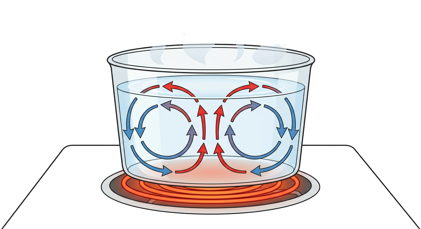
8. Observe the diagram showing convection currents. How do these currents relate to the movement of deep ocean water?
Related Worksheets
Geographical Boundaries Worksheet
Explore different types of geographical boundaries, their formation, and their impact on human societies and international relations.
Population Density Basics
Explore the concept of population density, its calculation, and factors influencing it with this Grade 10 social studies worksheet.
Understanding Global Time Zones
A Grade 10 Social Studies worksheet covering the basics of time zones, including their purpose, calculation, and global impact.
Population Studies Worksheet
This worksheet covers key concepts in population studies, including demographics, population growth, and factors influencing population distribution.
Meridians and Parallels Worksheet
Explore the concepts of meridians (lines of longitude) and parallels (lines of latitude) and their importance in geography and navigation.
Population Pyramid Analysis
This worksheet helps students understand and analyze population pyramids, their different shapes, and what they reveal about a country's demographic characteristics.
Understanding Map Projections
This worksheet covers various aspects of map projections, their types, distortions, and uses for Grade 10 Social Studies students.
North American Historical Maps
Explore the historical evolution of North America through maps, focusing on territorial changes, indigenous lands, and colonial influences.