Population Density Basics
Explore the concept of population density, its calculation, and factors influencing it with this Grade 10 social studies worksheet.
Includes
Standards
Topics
Population Density Basics
Name:
Date:
Score:
Read each question carefully and answer to the best of your ability. Show all calculations where necessary.
1. Define population density in your own words.
2. The formula for calculating population density is .
3. If a country has a population of 50 million people and an area of 100,000 square kilometers, its population density is people per square kilometer.
4. Which of the following is NOT a major factor influencing high population density in a region?
Fertile land for agriculture
Access to clean water
Remoteness from trade routes
Industrialization and job opportunities
5. A high population density always indicates a high quality of life.
True
False
6. Imagine two cities, City A and City B. City A has a population of 1 million people and an area of 500 square miles. City B has a population of 500,000 people and an area of 100 square miles. Which city has a higher population density? Show your work.
7. Observe the map below, which shows general population density patterns across the globe.
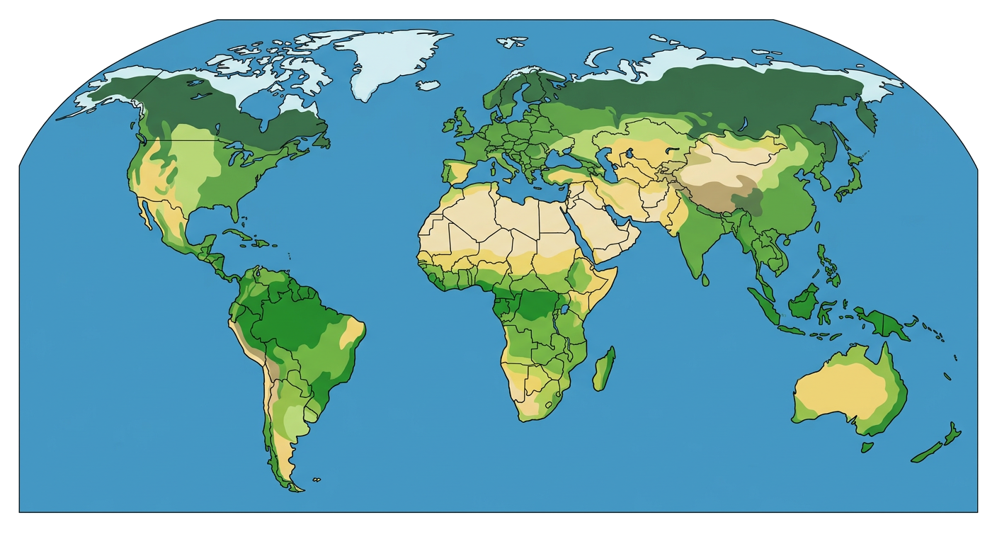
Based on the patterns observed, identify two regions with high population density and two regions with low population density. Briefly explain a possible reason for the density in each region.