Elevation Maps Worksheet
Explore the principles of elevation maps, contour lines, and their applications in geography and social studies for Grade 11 students.
Includes
Standards
Topics
Elevation Maps Worksheet
Name:
Date:
Score:
Read each question carefully and answer to the best of your ability. Refer to your knowledge of elevation maps and geographical concepts.
1. What do closely spaced contour lines on an elevation map indicate?
A gentle slope
A steep slope
A flat area
A valley
2. What is the primary purpose of an elevation map?
To show political boundaries
To depict landforms and terrain
To illustrate population density
To highlight climate zones
3. A contour line connects points of equal on an elevation map.
4. The difference in elevation between two adjacent contour lines is called the interval.
5. Explain how V-shaped contour lines can indicate the direction of water flow in a river or stream.
6. Contour lines can cross each other on an elevation map.
True
False
7. Index contour lines are typically thicker and labeled with their elevation.
True
False
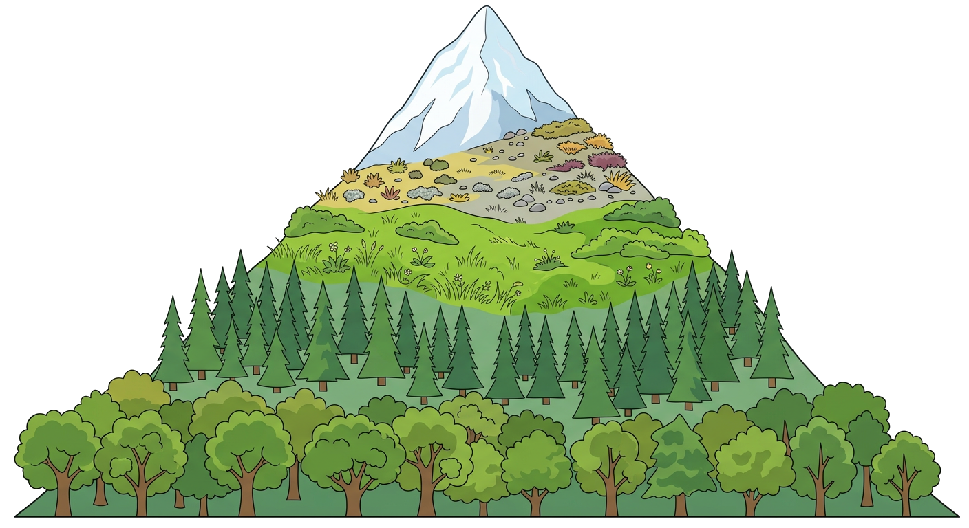
8. Observe the provided image of a mountain with elevation zones. Describe how the different colors and shading represent changes in elevation.
Related Worksheets
Map Projections Worksheet
Explore different types of map projections, their characteristics, distortions, and applications in this Grade 11 Social Studies worksheet.
Meridians and Parallels Worksheet
Explore the fundamental concepts of meridians (lines of longitude) and parallels (lines of latitude) and their importance in geographical positioning and time zones.
Population Density Analysis
This worksheet explores the concept of population density, its calculation, factors influencing it, and its environmental and social impacts at a Grade 11 level.
North America Historical Maps Worksheet
Explore the historical evolution of North American maps and their significance in understanding historical events and territorial changes.
Time Zones Worksheet
Grade 11 Social Studies worksheet on understanding time zones, their calculation, and impact on global communication and travel.
Population Graphs Analysis
A Grade 11 Social Studies worksheet focusing on the analysis and interpretation of population graphs, including population pyramids and demographic transition models.
Geographical Boundaries: An 11th Grade Exploration
Explore the concepts, types, and impacts of geographical boundaries on societies and international relations with this comprehensive worksheet.
Antarctica: The Frozen Continent
An 11th-grade social studies worksheet exploring the geography, climate, and geopolitical significance of Antarctica.