Boundary Exploration: Geopolitical Dynamics
This worksheet explores the complexities of boundary exploration, focusing on historical contexts, geopolitical implications, and contemporary challenges in defining and managing international borders at a Grade 12 level.
Includes
Topics
Boundary Exploration: Geopolitical Dynamics
Name:
Date:
Score:
Read each question carefully and provide thoughtful, well-supported answers based on your knowledge of boundary exploration and geopolitical dynamics.
1. Which of the following best describes the concept of a 'natural boundary' in geopolitics?
A boundary established by international treaty agreements.
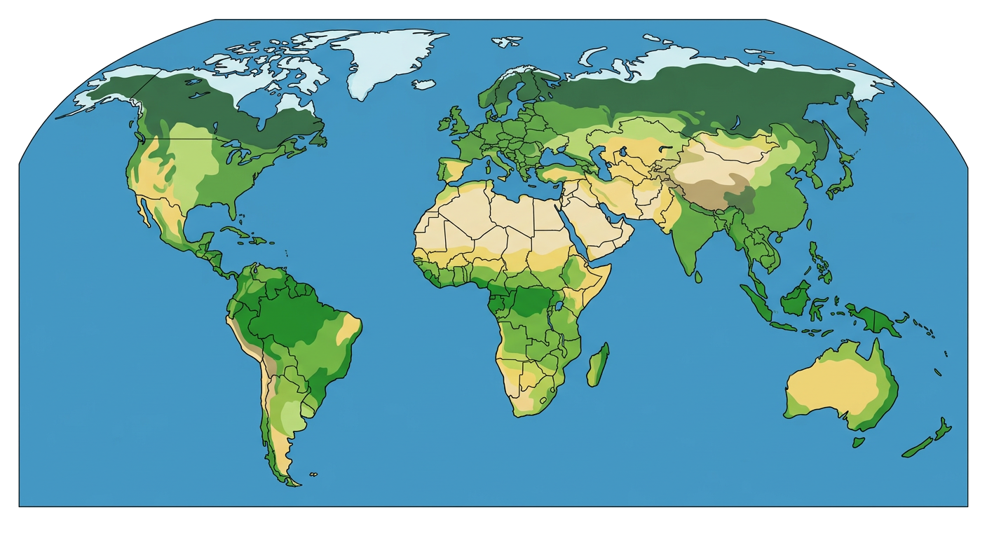
A boundary that follows a physical feature like a river or mountain range.
A boundary created based on cultural or linguistic divisions.
A boundary arbitrarily drawn on a map by colonial powers.
2. The 'Scramble for Africa' in the late 19th century is a prime example of:
The peaceful resolution of boundary disputes through international mediation.
The establishment of boundaries based on pre-existing ethnic and cultural divisions.
Imperial powers arbitrarily drawing boundaries with little regard for local populations.
The development of indigenous mapping techniques for boundary demarcation.
3. The concept of refers to the belief that a nation's destiny is to expand its territory.
4. A is a region caught between stronger colliding external cultural-political forces, under persistent stress, and often fragmented by aggressive rivals.
5. Explain how technological advancements in mapping and exploration have influenced the process of boundary demarcation over time.
6. Superimposed boundaries are typically drawn by an outside power without regard for existing cultural landscapes.
True
False
7. Irredentism is a political movement that seeks to reclaim or reoccupy a lost or unredeemed territory.
True
False
Match each term on the left with its definition on the right.
8. Antecedent Boundary
a. A boundary that existed before the cultural landscape emerged.
9. Subsequent Boundary
b. A boundary that developed contemporaneously with the evolution of the cultural landscape.
10. Relic Boundary
c. A former boundary line that no longer functions as such but is still discernible in the cultural landscape.
11. Observe the provided world map. Identify two regions where boundary disputes are currently prominent and briefly explain the historical or geopolitical factors contributing to these disputes.