Understanding Map Projections
This worksheet introduces 6th-grade students to different map projections and their effects on representing the Earth's surface.
Includes
Standards
Topics
Understanding Map Projections
Name:
Date:
Score:
Read each question carefully and answer to the best of your ability. Some questions may require you to think about how different map projections distort the Earth's surface.
1. Why do cartographers use map projections?
To make maps more colorful
To flatten the Earth's curved surface onto a 2D map
To show only small areas of the Earth
To measure distances more easily on a globe
2. Which of the following is a common distortion found in map projections?
Perfectly accurate representation of all landmasses
Distortion of size, shape, distance, or direction
The ability to show the Earth as a perfect sphere
Elimination of all errors in mapping
3. A map projection is a method of representing the Earth's surface on a flat piece of paper.
4. The three main types of map projections are cylindrical, conic, and .
5. All map projections show the true size and shape of continents.
True
False
6. The Mercator projection is known for accurately representing the areas of landmasses.
True
False
7. What is one advantage and one disadvantage of using a cylindrical projection?
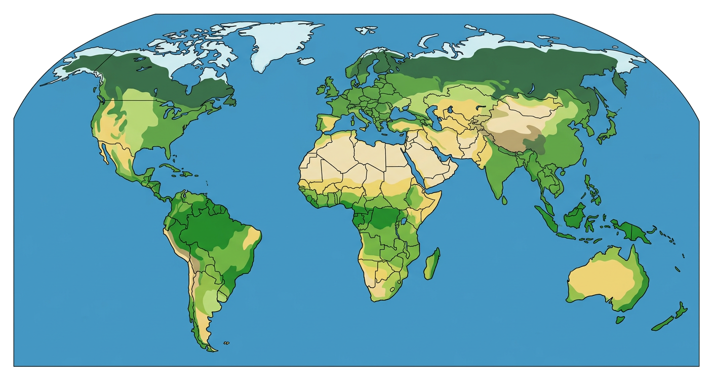
8. Look at the image below of a world map. Based on what you know about map projections, what kind of distortions do you think are present in this map? Explain your reasoning.
Related Worksheets
Exploring Mexico: A Geography Worksheet
A Grade 6 social studies worksheet focusing on the geography, culture, and history of Mexico.
Topographic Map Reading Skills
A worksheet for 6th graders to practice reading and interpreting topographic maps, focusing on contour lines, elevation, and landforms.
Understanding Population Graphs
A worksheet for 6th graders to understand population graphs, including population pyramids and their interpretation.
Meridians and Parallels Worksheet
Explore the concepts of meridians (lines of longitude) and parallels (lines of latitude) and their importance in geography.
Exploring Topographic Maps
A Grade 6 social studies worksheet on understanding topographic maps, contour lines, and landforms.
Exploring Elevation Maps
A Grade 6 social studies worksheet on understanding and interpreting elevation maps, contour lines, and geographical features.
Climate Zones Worksheet
Explore the different climate zones of the world and their characteristics in this Grade 6 Social Studies worksheet.
Grade 6 Population Studies Worksheet
Explore population concepts, demographics, and factors influencing population distribution with this Grade 6 social studies worksheet.