Mapping Skills Worksheet
A worksheet to assess and develop grade 6 students' mapping skills, including understanding map elements, types, and reading coordinates.
Includes
Standards
Topics
Mapping Skills Assessment
Name:
Date:
Score:
Read each question carefully and answer to the best of your ability. Good luck!
1. Which map element helps you determine the actual distance between two points on a map?
Compass Rose
Map Key/Legend
Map Scale
Title
2. Lines of latitude run and measure distance or of the Equator.
east-west, north, south
north-south, east, west
diagonally, up, down
circularly, inward, outward
3. A map key, also known as a , explains the symbols and colors used on a map.
4. The imaginary line that divides the Earth into the Northern and Southern Hemispheres is called the .
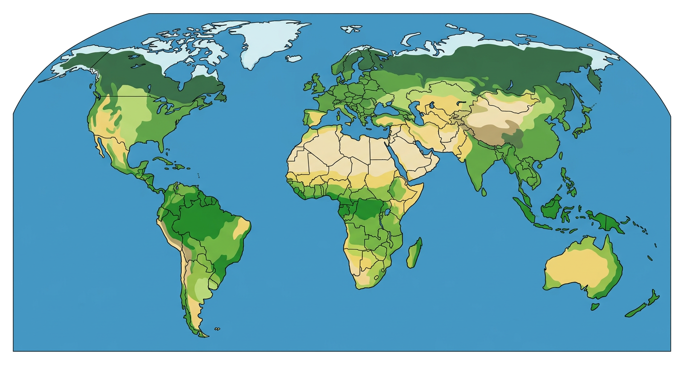
5. Look at the world map above. Name two continents that are completely in the Northern Hemisphere.
6. Explain the difference between physical maps and political maps.
7. All maps show the exact size and shape of landmasses.
True
False
8. The Prime Meridian is the starting point for measuring lines of longitude.
True
False
Match each term on the left with its definition on the right.
9. Hemisphere
a. The direction north, south, east, or west
10. Cardinal Directions
b. Half of the Earth
11. Latitude
c. Lines that run east to west around the globe
Related Worksheets
Exploring Mexico: A Geography Worksheet
A Grade 6 social studies worksheet focusing on the geography, culture, and history of Mexico.
Topographic Map Reading Skills
A worksheet for 6th graders to practice reading and interpreting topographic maps, focusing on contour lines, elevation, and landforms.
Understanding Population Graphs
A worksheet for 6th graders to understand population graphs, including population pyramids and their interpretation.
Meridians and Parallels Worksheet
Explore the concepts of meridians (lines of longitude) and parallels (lines of latitude) and their importance in geography.
Exploring Topographic Maps
A Grade 6 social studies worksheet on understanding topographic maps, contour lines, and landforms.
Exploring Elevation Maps
A Grade 6 social studies worksheet on understanding and interpreting elevation maps, contour lines, and geographical features.
Climate Zones Worksheet
Explore the different climate zones of the world and their characteristics in this Grade 6 Social Studies worksheet.
Grade 6 Population Studies Worksheet
Explore population concepts, demographics, and factors influencing population distribution with this Grade 6 social studies worksheet.